Plymouth County Storm Update: Hull Hits 58 MPH Gusts, Rockland Tops Rainfall Totals

Generated: Sunday, September 27, 2026 at 01:40 AM
Scope: County-wide impact assessment from the rare September coastal nor’easter.
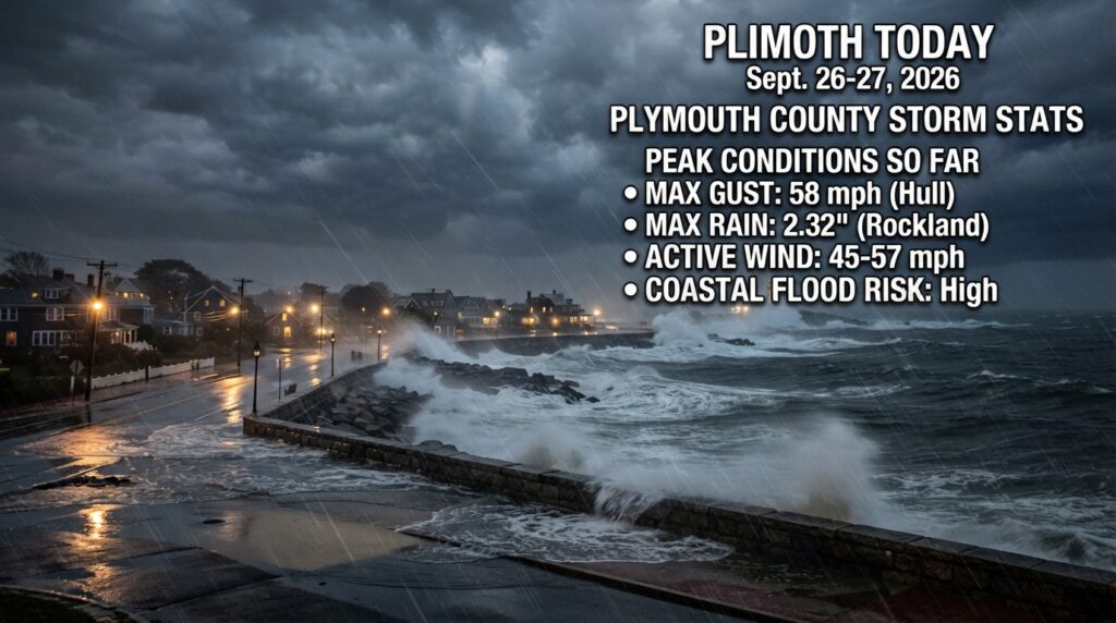
County Storm Peak Summaries
- Maximum Recorded Gust: 58 mph in Hull (Logged Saturday, Sept 26 at 10:03 PM)
- Maximum Recorded Rainfall: 2.32″ in Rockland (Logged Sunday, Sept 27 at 01:40 AM)
Meteorological Overview & Impacts
The high-impact, long-duration coastal nor’easter that began hammering Massachusetts on Friday, September 25, reached peak intensity over the weekend across Plymouth County. Driven by strong high pressure to the north and persistent onshore northeast gales, the slow-moving system has lashed local communities with gale-force gusts, saturated soils, and localized urban and poor-drainage flooding over multiple high-tide cycles.
Key Regional Observations:
- Wind Extremes: Coastal communities bore the brunt of the fierce winds, with Hull and Scituate both logging peak gusts of 56–58 mph late Saturday evening. Inland and mid-county towns widely experienced sustained winds and gusts hovering between 45–52 mph, putting heavy strain on full, leafy canopies and triggering scattered power outages. The Watchers News
- Rainfall Totals: Steady bands of heavy precipitation pushed totals past the 2-inch mark in spots like Rockland (2.32″), compounding saturation and minor urban flooding concerns alongside coastal surge.
Chronological Event Log Highlights
- [9/26/2026 – 03:44 PM] Initial Onset: Initial countywide tracking shows baseline gale forces setting in, with early gusts averaging 45–51 mph (Scituate registering 51 mph early on) and steady rainfall beginning to accumulate.
- [9/26/2026 – 06:59 PM] Escalation: Gusts ramp up across Hull (54 mph) and Hingham (52 mph), while rainfall rates accelerate along southern exposure routes like Mattapoisett (1.21″).
- [9/26/2026 – 08:18 PM] Mid-Evening Peak: Widespread high winds envelope the county; Duxbury, Plymouth, and Abington cross into the 49–52 mph threshold, and regional rain totals climb rapidly.
- [9/26/2026 – 09:53 PM to 10:03 PM] Peak Wind Window: The highest individual wind flags of the event are recorded. Hull peaks at 58 mph and Hingham hits 54 mph, matching concurrent severe gusts in Scituate (56 mph).
- [9/27/2026 – 12:41 AM to 01:40 AM] Heavy Moisture Saturation: Rain bands intensify dramatically past midnight, pushing Rockland to a county-high 2.32″ of total accumulation by 01:40 AM, alongside heavier pooling in Hingham (1.72″) and Wareham (1.76″).
Note: Emergency management teams and local utilities continue to monitor roadway clearance, coastal erosion risks around high tides, and isolated wire damage as the system slowly tracks further north.
The Watchers News
Tracking gusts across Plymouth County?
Monitor real-time wind speeds, direction telemetry, and localized weather alerts across the South Shore.